

PROGRESS UPDATE
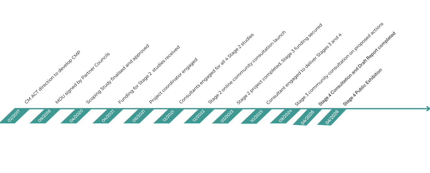
NSW Coastal Management Manual recommends that councils follow a five-stage risk management process for the preparation and implementation of a CMP.
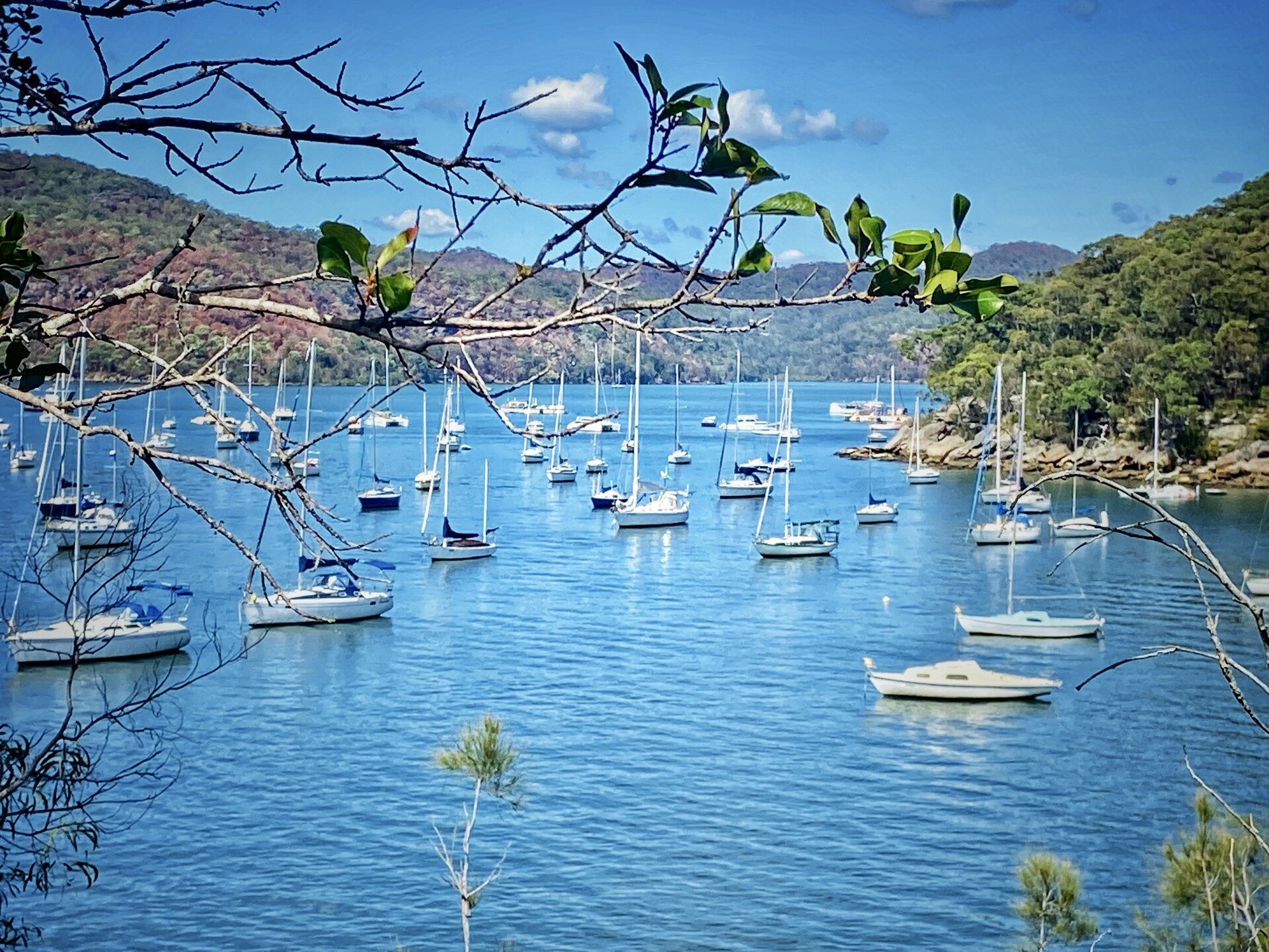
Stage 1 of the Hawkesbury Nepean River system CMP was officially completed in April 2020 with the release of the Scoping Study that has reviewed the history of managing the river system, developed a shared understanding of the current situation, and identified the strategic path of the remaining CMP stages.
The goal of Stage 2 was to address knowledge gaps that were identified in the Stage 1 Scoping Study. Stage 2 got finalised in March 2023 with the completion of five technical studies that you can learn more about below.
During Stage 3 we collated the information produced as part of Stages 1 and 2 and use a more complete picture of estuarine processes and relevant management issues to guide the identification, evaluation and selection of appropriate management actions to guide the management of the River system over the next 10 years.
As part of Stage 4 we assessed, ranked, and prioritized all your valuable feedback using a robust decision-making framework aligned with the NSW Coastal Management Framework. This process led to the identification of a shortlist of management actions now included in the Draft CMP report.

Alluvium Consulting Australia, 2021
COMMUNITY AND STAKEHOLDER ENGAGEMENT PLAN

In order to capture the values and involvement of the local community, First Nations groups, State Government Agencies, and other relevant stakeholders within and around the Hawkesbury Nepean River System in the Coastal Management Plan, a Community and Stakeholder Engagement Plan has been developed by Water Technology Pty Ltd. This document aims to outline a strategy for how the HNRS Steering Committee will proceed with the meaningful engagement of these various groups.
The report can be viewed here.
ABRIDGEMENT REPORT
Abridgement report (or summary report) on The Hawkesbury River System Physical and Ecological Processes, developed by Alluvium Consulting, provides an overview of the state of knowledge of the physical and ecological processes that operate in and impact on the Hawkesbury Nepean River System estuary.
The report identified and categorised stressors and threats that impact most heavily on the ecological function of the river system, assessed vulnerability of key estuarine ecosystems and habitats to these stressors and further refined actions that can support the ongoing and integrated management of the estuary.
Report also serves as a great point of reference for any future research efforts, acts as a centralised database for existing knowledge that will allow to keep track of the how relevant/up-to-date each dataset is at any point in time, and provides advice on restoration opportunities of already disturbed ecosystems and recommendations on potential legislative changes that will benefit our River environment in the long-run.
Review the report using a combination of:

Abridgement report study area

Hawkesbury River estuary bank erosion study area
HAWKESBURY RIVER ESTUARY BANK EROSION STUDY
To get a full picture of at-risk communities and locations susceptible to the bank erosion in the Hawkesbury River, 45 carefully selected locations along the Hawkesbury were assessed via a desktop study which investigated the geomorphic form, riparian vegetation extent, and change over time for each site. This was supported by field investigations where data was collected on site including extensive photos and site specific data relating to bank condition, causes and trajectory of erosion, and values associated with the site.
The desktop and field assessments were used to quantify the risk level for each site which informed the bank stabilisation options assessment process. Sites were grouped by considering risk, erosive drivers, and mitigation potential. Options for bank stabilisation were proposed and assessed for priority sites considering multiple potential benefits. These options will be further considered in the following stages of HNRS CMP development.
Review the report using a combination of:
PITTWATER COASTAL HAZARD ASSESSMENT
The Stage 1 Scoping Study of the CMP identified 6 beach embayments that required a beach erosion and shoreline recession update. The following tasks were undertaken at each of 6 locations using best contemporary practice, multiple lines of evidence and measured data where possible, in order to map erosion/recession hazard lines for 2040, 2070 and 2120:
Collation, digitization and tidal correction of aerial photography
Analysis of aerial photography, photogrammetry and survey data to calculate long-term recession rates
Storm (short term) erosion
Probabilistic analysis of erosion/recession due to longterm recession, sea level rise and storm erosion
Mapping of future erosion/recession hazard lines
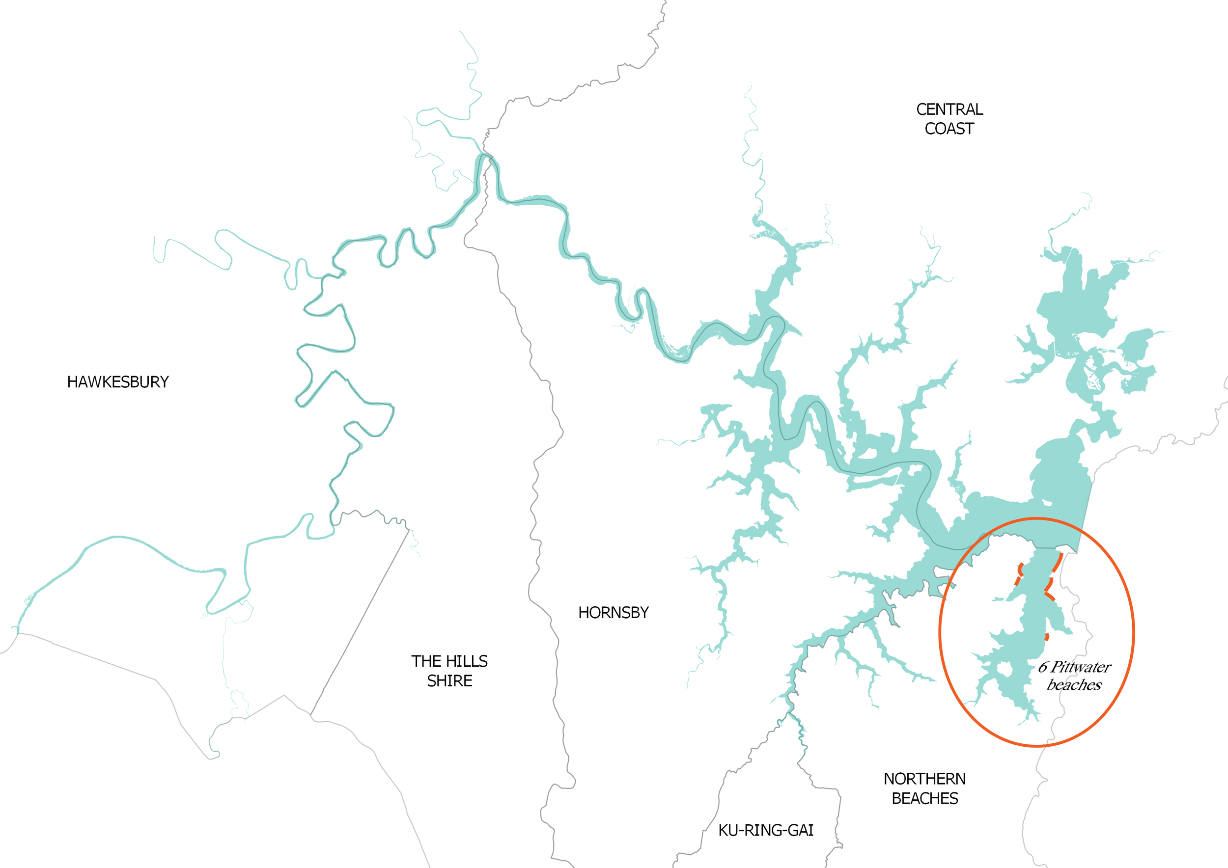
Pittwater Coastal Hazard Assessment study area
The final report has been incorporated into a suite of other hazard assessment studies produced by Norther Beaches Council that will be jointly assessed during Stage 3 to select appropriate management strategies to respond to identified hazards.
View timelapse videos (task 1 in the list above) for each of the six locations below:

Hawkesbury River coastal inundation study area
HAWKESBURY RIVER COASTAL INUNDATION STUDY
The foreshores of the Hawkesbury River and its related waterways, Pittwater, Brisbane Water, Broken Bay and Cowan Creek, are subject to periodic coastal inundation. Whereas evaluations of coastal inundation have previously been undertaken for Pittwater and Cowan Creek by Northern Beaches Council and for Brisbane Water by Central Coast Council, no such evaluations have been done for the Hawkesbury River in the past.
In the process of the study existing information on coastal inundation was reviewed and collated, existing coastal modelling was expanded and updated hydrodynamic model was ran to measure the extent of coastal inundation within the study area for three sea level scenarios:
the present day;
2050 (with 0.4 m of sea level rise (SLR)); and
2100 (with 0.9 m of SLR).
The report provided preliminary assessment of coastal inundation extent within the lower Hawkesbury study area that with further refinement can be used to inform planning and development controls for a range of purposes. This information can also be used as a foundation for Coastal Vulnerability Area (CVA) mapping for the purposes of the State Environmental Planning Policy (Resilience and Hazards) 2021 described under Clause 2.6 as well as for the interpretation of coastal inundation related hazards under other relevant environmental planning instruments.
COMMUNITY USES AND VALUES REPORT
There is a wealth of information that councils and other organisations have invested significant time, money and effort in to gain a better understanding of community values and uses associated with the HNRS catchment, coastal zone and marine estate. These efforts have also generated feedback from the community about attitudes towards and understanding of threats and stressors that jeopardise these values and uses. Hawkesbury Nepean River System Community Uses and Values Report serves as a review and collation of this information, synthesising it into an easily understandable format that is fit for the purpose of CMP development. This report is based on a desktop review and analysis of existing and available data.
Community Uses and Values study area
To stay informed on the progress with the Hawkesbury-Nepean River CMP, you can subscribe to receive our news and updates here.
Communication with our subscribers usually happens in the form of a newsletter that provides a concise summary of the latest progress with technical studies, past and future engagement opportunities, and other information pertinent to the CMP development process. You can view all the issues of the newsletter released to date below:


The eleventh issue of the Hawkesbury Nepean River System CMP newsletter provides details on how you can submit your comments to Stage 4 of the CMP. Let us know how the River can better be managed into the future - submit your comments on the Draft Stage 4 report